
Ecologically significant vegetation and habitat on private land is being lost at a rate comparable to pre-1840 deforestation, according to a study by Landcare Research scientists, Adrian Monks, Ella Hayman and Susan Walker. Their analysis of vegetation clearances over 27 years from 1989 to 2015 has recently been published in the New Zealand Journal of Ecology and identifies some alarming trends.
The researchers found that native forest is the type of vegetation least likely to be cleared, but it seems that native shrublands and other types of habitat aren’t so highly valued.
“We need to understand where and why loss is occurring in order to aid the planning, advocacy and prioritisation of efforts to secure the remaining biodiversity in these landscapes. Land uses continue to evolve, and a key need is to understand what those changes might mean for the habitat security of the indigenous biota,” the researchers explain.
According to Ministry for the Environment and Statistics New Zealand figures, 31 000 ha of tussock grassland, 24 000 ha of indigenous shrubland, and 16 000 ha of indigenous forest were cleared across New Zealand in the 16 year period from 1996 to 2012, in addition to many other areas of habitat for native species.
“Continued loss represents an ongoing threat to New Zealand’s remaining biodiversity. The area of indigenous vegetation and habitat remaining on New Zealand’s primary agricultural lands continues to decrease, but it has been difficult to obtain reliable estimates of the extent and causes of loss. We assess change and identify predictors of vegetation clearance in 856 recommended areas for protection (RAPs) from 35 ecological districts in the North and South Islands, for the period 1989 to 2015.”
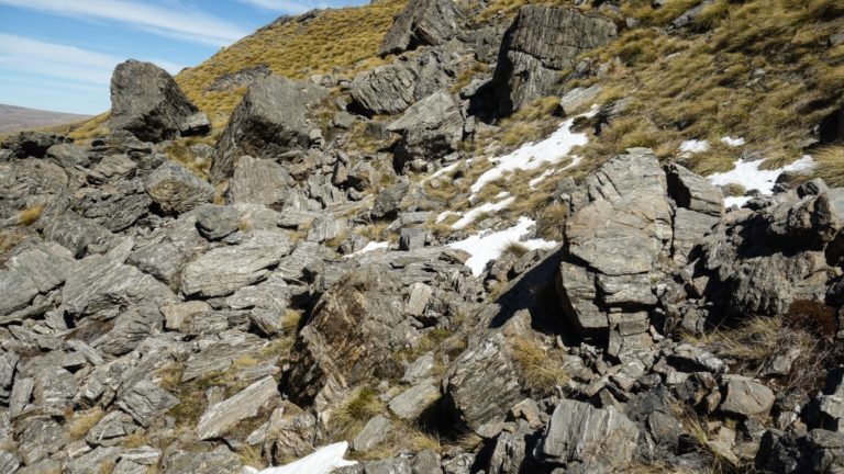
Land under Department of Conservation protection isn’t evenly representative of the full range of ecological habitats and tends towards the types of landscapes considered unsuitable for agriculture. That means land in private ownership is also crucial for maintaining native biodiversity.
“Thirty-two percent of New Zealand’s total land area is currently managed by the Department of Conservation (DOC). However, land protected for conservation purposes was mostly not initially suitable for agriculture, and so mountainous regions are over-represented and lowland areas are poorly represented. This pattern has continued through the tenure review process, which has overseen the retirement of thousands of hectares of Crown pastoral lease into public conservation lands, mostly at higher elevations and the privatisation and often consequent subdivision and development of land at lower elevations. As a result, indigenous cover that now remains on low-elevation private land is critical to landscape-scale ecological integrity. In some cases, the last representatives of many ecosystems are only found on private land.”
Many private landowners have acted to protect valuable ecosystems on their land through QEII Trust, and Ngā Whenua Rāhui covenants and by fencing those legally protected areas off from grazing stock. But such protection is dependent on the conservation awareness and willingness to make a commitment, of each individual landowner.
Irrigation schemes and technology developments have also meant that land historically considered unsuitable for agriculture, can now potentially be developed.
“Pastoral development was initially limited to the most arable areas (the flatter, more fertile and warmer lowland), but later programmes (such as the land clearance subsidies of the 1970s and early 1980s) saw increasingly marginal lands cleared for agriculture. The combined effects were sufficient to see most gently sloping land at low elevations cleared for agriculture or urban use, as well as much of the lower-elevation hill country. In recent decades, the development of irrigation infrastructure and the transition to high-input agriculture mean that much previously marginal land is now economic to develop, heralding a fresh wave of threats to remnant native vegetation on private land. As a result of all these pressures, natural ecosystems at low to moderate elevations in drier and warmer environments are greatly reduced from their former extent and remain at risk of clearance.”
So what has been lost in recent decades and what can be done about it?
“We used publicly available digitised maps of RAPs (Recommended Areas for Protection) from PNAP surveys to identify areas of ecologically significant vegetation. While primarily native, this vegetation may also be exotic or contain exotic components because RAPs were also identified on the basis of being habitat for native fauna. Change due to vegetation succession was not classified as a change for this analysis.”
“Over 27 years, 7152 ha of Recommended Areas for Protection (RAPs) were cleared (2.3% by area), with rates varying over space and time. Native forest was least commonly cleared (422 ha removed), followed by native non-woody vegetation (1294 ha), native shrubland (1378 ha), and ‘other’ vegetation (4058 ha). The probability of clearance peaked during 2001 to 2008 at 0.14% per year, but it was still nearly double the 1989–2001 levels (0.06% per year) from 2008 to 2015 (0.11% per year). The annualised clearance probabilities after 2001 were comparable to the rates of deforestation in the pre-1840 period of human settlement and about a third of that recorded from 1840 to 1970, the most intensive known period of anthropogenic clearance in New Zealand.”
Smaller RAPs were particularly vulnerable to clearance. Perhaps being small they were seen as less valuable, although even isolated habitat patches can contribute to the conservation of native organisms through a linked-up landscape of many such patches.
“Clearance rates were higher around the edges of small RAPs without legal protection and in drier, cooler areas, generally and increasingly over time. Amount of surrounding cropping/horticulture was negatively associated with clearance, as initially was dairy before developing a slightly positive association. Forestry was positively associated with clearance up until 2008. Our results show proportionally greater clearance of marginal agricultural land with high biodiversity values as time goes on, probably facilitated by the increasing use of technology, such as irrigation and fertilisation, to circumvent environmental limitations to plant growth. These results demonstrate ongoing attrition of the highest-value native habitat remaining on private land, and the inadequacy of the current protection framework to safeguard it.”
The study also identified clear differences in loss rates between districts.
“Very high rates of loss were recorded in Māniototo in the second time period (2001-2008, 13.7% per year), but no loss in any period for the more mountainous regions such as Ahuriri, Arrowsmith, Ben Ohau, Grampians and Hawkdun ecological districts. The patterns highlight a shift in the focus of new agricultural development from the East Coast region of the North Island from 1989 to 2001, to the inland basins of Canterbury and Otago from 2001 to 2015. The risk to vegetation in the North Island remains moderate throughout, with no ecological districts free from clearance. Peaks in the South Island are associated with a 2001–2015 development pulse, and contrast with the several high-altitude RAPs that had no recorded clearance.”
“Our data display a pattern consistent with native vegetation and habitat for native biodiversity on private land being under increasing pressure from development between 1989 and 2015, and legal protection (covenants) being a strong, albeit imperfect, guarantor of security for native vegetation. Legal protection prevented loss and was increasingly effective over time compared to unprotected lands. Nevertheless, some clearance on protected land was observed, mostly by ploughing or spraying and on the scale of a few hectares (up to 13 ha in a single RAP).”
One instance of clearance on protected land involved the installation of a predator-proof fence (1.7 ha at Redbank, Macraes Flat), but in most cases loss represented clearance for agriculture or forestry (38 ha over entire study).
“Consistent with our expectations, small patches were more vulnerable to clearance than large patches, and clearance from the edge of larger fragments was more common than clearance of the core. Both forms of loss are incremental and the type of change least likely to be noticed by regulators. Moreover, edges and small fragments are likely to have reduced native dominance compared to the interior of large tracts of vegetation and therefore may not be perceived as particularly valuable, or even a nuisance for some farming operations. However, the effect of gradual attrition of the edges of larger fragments, exposing more of the interior to edge effects, is an inevitable slow decline of the ecological integrity of larger tracts, which are essential for conserving many biotic groups.”
Previous researchers have found that forest beetle communities are affected by edge effects for up to 1 km from the edge, for example, and many New Zealand forest birds are only found in heavily forested areas.
“While clearance of all vegetation types increased between 1989–2001 and 2001–2008, the vulnerability of native shrubland to loss has increased the most across all periods of the study, with forest vulnerability also showing a consistent upwards trajectory over time. Short-stature, native, non-woody vegetation, such as grasslands, went from second most likely vegetation type to be cleared in 1989–2001 to most secure by 2008–2015. We do not understand the drivers of the change in status of the different vegetation types, which could be due to changes in economic drivers, regulatory awareness, or just running out of accessible examples of the vegetation type.”
Given their findings, it is unsurprising that the researchers believe district planning processes are currently inadequate.
“The progressive clearance of identified RAPs (‘the best of what remains’) over the last 26 years demonstrates that existing protections afforded through district planning processes are inadequate for maintaining ecologically significant native vegetation or habitats, and by extension native biodiversity, on private land. Recent rates of loss are comparable to deforestation in other periods since human settlement, and the natural protection afforded in the past by the low inherent productivity of marginal land has diminished as technologies and economic circumstances have changed. Formal legal protection has constrained clearance, but this protection is mainly provided for vegetation that private owners have no intention of clearing anyway.”
The full study is reported in the New Zealand Journal of Ecology and is freely available online.