
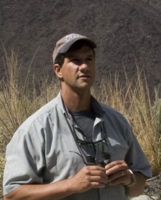
Professor Phil Seddon is Director of Otago University’s Postgraduate Wildlife Management Programme and has been involved in species restoration programmes around the world.
He currently acts as an advisor on projects as diverse as saving critically endangered Bali starlings in Indonesia (the wild population dropped to a low of 15 in 1990), wild camels in Mongolia and the Northern Bald Ibis – a critically endangered migratory bird formerly found in Southern Europe and North Africa.
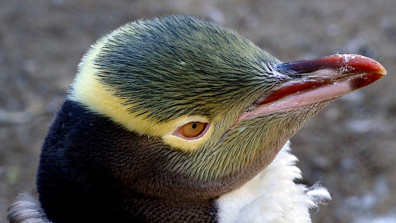
But first there were yellow-eyed penguins. Phil’s doctorate, completed at Otago, was a study of predation on yellow-eyed penguins by introduced predators in modified habitats along Otago’s southern coast. Post-doctoral studies on more penguins – South African ones this time – took him to the African continent where he later became involved in conservation projects in desert habitats. That, in turn, led to species restoration work in the Middle East.
Nowadays, based again at Otago University, Phil maintains a research interest in yellow-eyed penguins – particularly with respect to the impacts of nature tourism on these shy and sensitive birds – but a main research interest currently is in the spatial ecology of New Zealand’s introduced mammal predators. That research may one day help to advise you on where exactly is the best spot to place your predator traps.
So what is spatial ecology?
“Spatial ecology involves using very small GPS tracking devices – small enough so as not to influence natural behaviour – to get an accurate record of the movements of a predator in its environment,” Phil explains. “You can then quantify what features an animal is selecting within its environment and how it moves within it.”
The technology allows researchers to identify hotspots and favoured areas where that animal is most likely to be found – and hence where it can best be trapped. The devices can currently be used on animals as small as feral cats, possums, stoats and hedgehogs.
Most trapping in New Zealand involves best-guess placement of traps, based on the knowledge and experience of the trapper. One trap may catch predators – the next one along may not – without any obvious reason for the difference. Phil hopes that his work will help to change that.
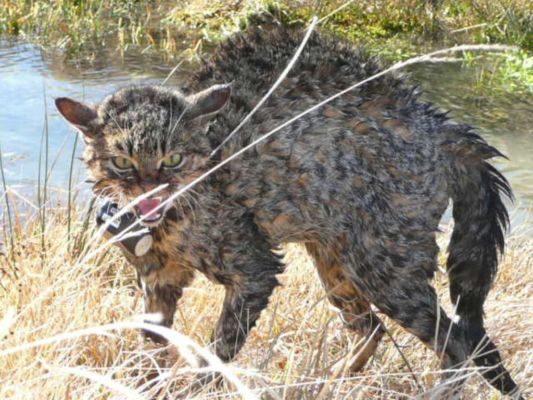
Phil has worked with the Department of Conservation on recovery of black stilts, takahe and yellow-eyed penguins. It is in the Waitaki Basin, home to black stilts, that he is utilising tracking technology to map out the movements of the long-established feral cat population which hunt the local rabbits.
“Cats don’t control rabbits,” says Phil. “Rabbit numbers control cats. Rabbits are the drivers of the cat population.”
Feral cats can also potentially prey on braided river nesting birds – including black stilts – particularly if numbers of rabbits are reduced. But Phil’s tracking work with feral cats has shown that braided rivers aren’t a favoured habitat of the cats. They prefer the vegetated river margins, with access to open sites where they can find rabbits.
One of Phil’s PhD students has been investigating the ‘safe island’ hypothesis in braided rivers. Does a braided river island surrounded by deep, fast-flowing water offer safety to nesting birds? Should braided river birds be encouraged to nest on such islands?
The answer is ‘not necessarily’.
“Big, stable river islands’ quickly become vegetated. Once there’s vegetation, rabbits find their way there and where rabbits go, feral cats and other predators follow.”
Big, stable islands – it turns out – can have lots of predators.
“It’s a consequence of modifying the rivers,” says Phil. “When you remove the ability of the river to flood, exotic vegetation grows.”
Concession funding from gravel extraction operations is being used experimentally to manipulate and create islands. The aim is to create an environment that both discourages predators and encourages birds to breed.
“There are so many areas where predator fences don’t work,” says Phil, “rivers, coastal areas. And even where you can fence a sanctuary, it’s not really predator-proof. It is just a more efficient form of predator control.”
As it happens, fine-scale spatial ecology work has applications for predator-free areas too.
“Fencing is very expensive. By better understanding how predators live and move through their environment, pathways of potential reinvasion can be identified,” Phil says.
Those hotspots can then be intensively trapped or fenced, rather than trying to fence an entire perimeter. As mainland sanctuaries increase in size, it is a management technique that is likely to become increasingly important in the future.
“Smart people are coming up with better traps, better poisons, self-resetting traps etc,” says Phil, “but we still need to know where to put the traps and poisons out. Understanding more about the spatial ecology of key predators is the next step.”
For those who don’t have access to satellite tracking technology but want to learn more about the spatial ecology of predators and better trap placement in their own ‘patch’, Phil recommends good record-keeping.
“Describe the site immediately around where you’re put each trap and then record whether each trap catches anything or not. That way you can build a description of the fine-scale environmental features associated with trapping success .”
If a number of volunteer groups compiled such records, this “citizen science” data could potentially be combined to form a powerful spatial ecology resource. Something to think about, perhaps…